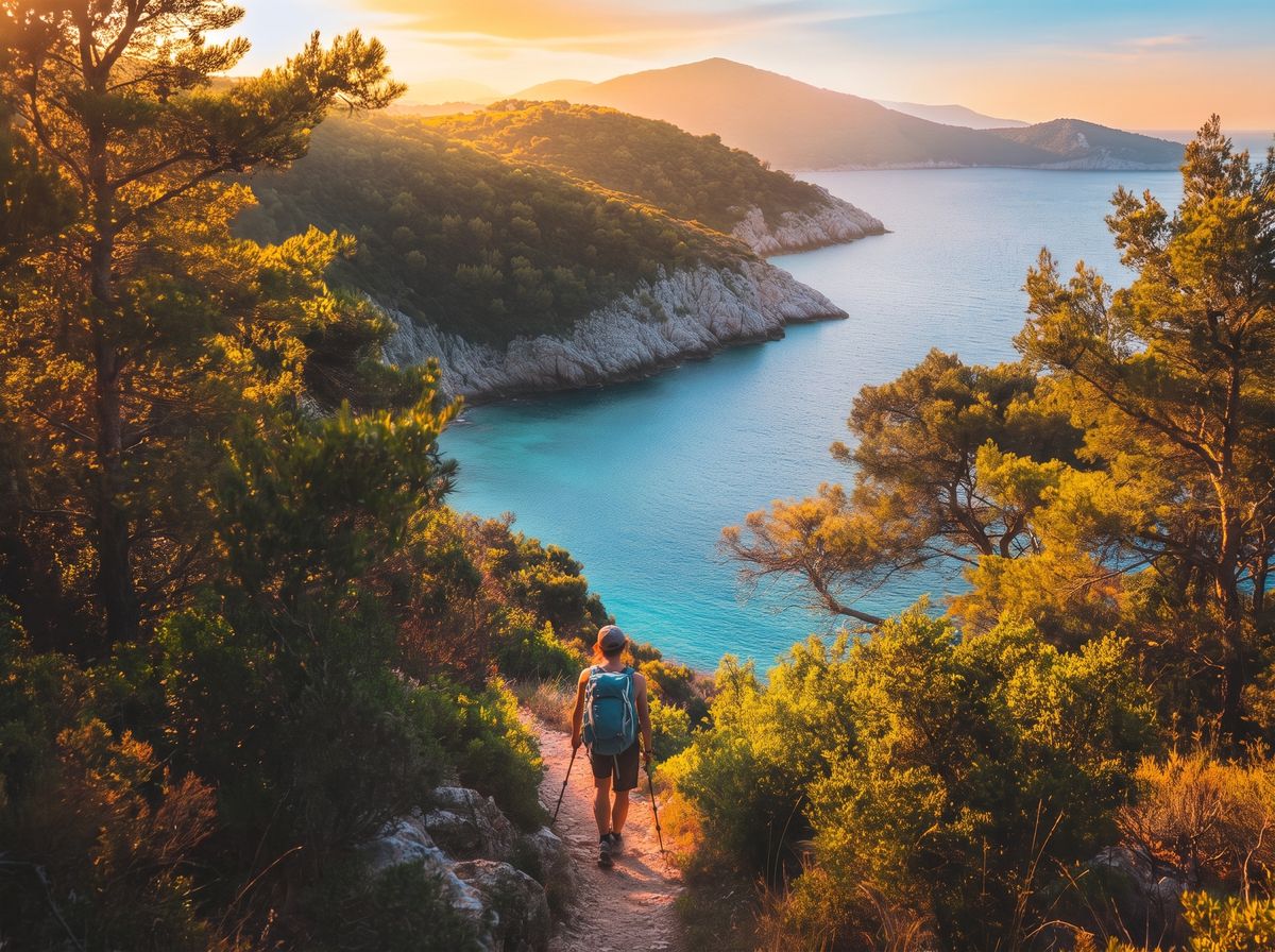
Elba Island is a paradise for fans of outdoor activities. Its diverse landscapes – from sea to mountains and forests – provide the perfect setting for outdoor sports all year round.
01Trail running
02Orienteering
03Paragliding
04Climbing
05Mountain biking
06Hiking
These and many more activities await in every season, thanks to a mild climate and well-marked trails.
This section gathers the best outdoor experiences to explore Elba actively and sustainably, while staying in close contact with its natural beauty.
The trail network
Elba's finest trails
The trail network of the Tuscan Archipelago National Park covers about 375 km, waymarked with the classic CAI red-and-white sign. Every route is graded by difficulty, length and elevation gain. Here is a selection of the most significant trails, filterable by difficulty.
Filter:
Easy
🏖
6,2km
Biodola Trail
Portoferraio • North coast
120 m D+1h 45' Families
A scenic loop linking Biodola beach to Scaglieri through wooded headlands. No technical difficulty, firm ground. Ideal with children, with unforgettable views over the gulf of Portoferraio.
Biodola beach • car park
Easy
🌊
5,4km
Capo d'Enfola – Coastal Loop
Portoferraio • North-west headland
80 m D+1h 30' Everyone
A loop around the Capo d'Enfola headland with views over both sides of the gulf. Through mastic and juniper to the former tuna fishery. On arrival: calm waters ideal for snorkelling. Lovely at sunset too.
Capo d'Enfola car park (free)
Easy
🍇
7,5km
Capoliveri Vineyards Trail
Capoliveri • South coast
160 m D+2h 15' Adults
A loop through the Capoliveri vineyards with views over the Gulf of Stella and Lacona. In September it coincides with the Aleatico grape harvest. Trail and gravel roads, never exposed.
Piazza Garibaldi, Capoliveri
Medium
🏰
10km
Volterraio Trail
Rio • East coast
340 m D+3h Adults
The climb to the Volterraio Fortress (about 394 m), Elba's most striking medieval stronghold, of Pisan origin. The trail crosses dense scrub and offers spectacular views over the gulf of Portoferraio and the archipelago.
SP26 junction, Rio nell'Elba
Hard
🏆
8,5km
Ascent of Monte Capanne – Summit 1019 m
Marciana • Peak of the Tuscan Archipelago
780 m D+4-5h Summit
Elba's most iconic ascent: from Marciana to the highest peak of the Tuscan Archipelago on a granite trail that is often exposed. At the top, a 360° view over Corsica, Capraia, Pianosa and Monte Argentario. In summer, set off at dawn.
Marciana Alta or cable car
Expert+
🏢
55km
Grande Traversata Elbana (GTE)
From Cavo to Patresi / Pomonte • ridge
2000+ m D+3-4 days GTE
The island's backbone: from Cavo the route crosses Elba along the ridge before splitting near Monte Capanne. Technical terrain, best done over 3-4 stages with overnight stops. An unforgettable experience for fit hikers.
Cavo (Rio) • bus or ferry
Recommended apps: download offline maps on Komoot or Wikiloc before setting off: in many areas around Monte Capanne there is no data signal, but GPS still works. The CAI 1:25,000 map of Elba can be found in Portoferraio or online.
The most ambitious route
Grande Traversata Elbana
The GTE is the island's most iconic long-distance trail and the backbone of the whole network. It starts at Cavo, on the east coast, and crosses Elba along the ridge before splitting near Monte Capanne into two branches.
▲ North branch
Cavo → Patresi
About 55 km to the western tip of Patresi, passing through the Monte Capanne area. The longest and most scenic branch of the crossing.
55 kmCavo → Patresi
▼ South branch
Cavo → Pomonte
About 47 km to Pomonte, on the island's south-west side. It ends a short walk from the bay of the Elviscot wreck.
47 kmCavo → Pomonte
GTE logistics: the route is tackled over 3-4 stages with overnight stops along the way. Elban guides and tour operators offer packages with luggage transfer, while the Elba CAI section organises group outings open to all.
With children
Hiking for families
Elba offers dozens of routes suitable for children aged 4 and up. The key features: elevation gain under 150 m, firm ground with no exposed sections, duration under 2 hours and an appealing finale such as a beach, a fortress or a viewpoint.
🏖
Biodola Trail
Portoferraio • 6.2 km • 120 m D+
The family classic: two beaches linked by a wooded path. Children love arriving at Scaglieri for a swim.
From age 5
🌊
Capo d'Enfola
Portoferraio • 5.4 km • 80 m D+
An almost flat headland with breathtaking views. The snorkelling finale in the calm water is the little ones' reward.
From age 5
🏰
Rada Promenade
Portoferraio • 4.8 km • 80 m D+
Almost flat, with views of the Medici forts. Very easy to combine with a visit to Portoferraio's old town.
From age 4
Safety with children: always carry plenty of water (min 500 ml per child), snacks, sun protection and plasters. In summer set off by 8:30. Closed or trekking shoes for the little ones too: never flip-flops on the trails.
The roof of the Archipelago
Monte Capanne: 1019 metres above the sea
Monte Capanne is the highest point of the Tuscan Archipelago. At the top, a 360° view that on clear days reaches Corsica, Capraia, Pianosa, Giglio and the Tuscan hills. For those who would rather not walk up, the Marciana cable car reaches the summit in about 18 minutes.
Easy Way
Marciana Cable Car
About 18 minutes from the Marciana station to the summit. Open from Easter to the end of October. Ideal with children and seniors; short scenic trails along the ridge start from the upper station.
EUR 18 return • ~18 min
Classic Way
Trail from Marciana
A CAI trail climbing from the village of Marciana. 4-5 hours return, 780 m of elevation, granite terrain with exposed sections. The most thrilling way: in summer, set off at 6:00.
Free • trekking shoes required
Alpine Way
South Ridge
For mountaineers: sections on granite of grade I and II. Not CAI-waymarked, reserved for those with alpine-terrain experience. A mountain guide is recommended.
Mountain guide recommended
High-altitude safety: in summer temperatures are 8-10°C lower than on the coast, but the sun is intense. Carry at least 2 litres of water, SPF50+ and a hat. In case of a storm (frequent on summer afternoons) descend immediately: the ridge is exposed to lightning.
Certified guides
Guides and leaders
Elba's hiking guides know every trail, every rock and every herb of the scrub. Relying on a guide means not only greater safety, but also an understanding of the land that no app can offer.
Good gear is not a luxury, it is safety. On Elba conditions change quickly: an easy trail in October is a pleasure; the same route in August, without water and a hat, becomes dangerous.
🥾
Trekking shoes
Vibram sole and good ankle support for medium and hard routes. For easy ones: closed shoes with non-slip soles. Never sandals or flip-flops on the trails.
Required for medium+ routes
💧
Plenty of water
At least 1.5 litres for short routes, 2.5 litres for medium and long ones. Natural springs along Elba's trails are rare: do not count on refilling along the way.
Always, required
🧢
Hat and UV protection
Elba's sun is intense even in spring. A wide-brimmed hat, UV sunglasses and SPF50+ cream even for short summer outings.
Required in summer
📱
Phone and offline map
Download the map on Komoot or Wikiloc while connected: GPS works offline too. Save the numbers 112 (emergency) and 118 (medical rescue).
Always, required
🩹
First-aid kit
Plasters, elastic bandage, disinfectant, painkiller. For technical routes add a thermal blanket. Essential far from inhabited areas.
Recommended for medium+
🧥
Waterproof layer
Even in summer, sudden storms are possible at altitude. A hooded windproof jacket weighs a few grams but can save the day.
Recommended at altitude
When to go
The seasons of Elban hiking
🌸
Spring
★★★★★
Best season
Mar-May: 15-22°C, fragrant scrub in bloom, cool trails and no crowds. Medium routes are tackled easily. The ideal time for the GTE.
☀️
Summer
★★★
Mornings only
Jun-Aug: intense heat at low elevations. Coastal and medium routes only before 9:30. Monte Capanne is still doable, but with a dawn start.
🍂
Autumn
★★★★★
Best season
Sep-Nov: golden colours, Marciana chestnuts, events and guided walks. Empty trails and 15-22°C. October is the golden month for walking.
❄️
Winter
★★★★
For those seeking quiet
Dec-Feb: cool, often sunny, very clear air and excellent visibility. Deserted trails; coastal routes are always walkable.
Frequently asked questions
FAQ – Hiking on Elba
Do I need trekking shoes or are sneakers enough?
It depends on the route. For easy trails (Biodola, Capo d'Enfola, Rada Promenade) closed sports shoes with non-slip soles are enough. For medium and hard routes, especially Monte Capanne, you need trekking shoes with a Vibram sole and high ankle support: the granite terrain is uneven and slippery when wet. Always avoid sandals and flip-flops.
Can Monte Capanne be done with children?
The classic trail is not advised for children under 10 because of its length (4-5 hours) and exposed rocky sections. The ideal family alternative is the Marciana cable car, which reaches the summit in about 18 minutes (ticket about EUR 18 return). From the upper station, short ridge trails are suitable for younger children too.
Are the trails well marked? How do I find my way?
The main trails are marked with the CAI red-and-white sign. Signage is generally good but can be patchy on minor sections. It is always best to download the offline map (Komoot, Wikiloc) and keep GPS on. The CAI 1:25,000 map of Elba is sold in Portoferraio; the CAI also organises group excursions open to all.
How much does a hiking guide cost?
As a rough guide: a half day (3-4 hours) in a group costs about EUR 15-25 per person; a full day (6-8 hours) EUR 30-60; the guided GTE over several days EUR 80-150 per person, often with luggage transfer. Private outings cost more. Book at least 48 hours in advance.
Can dogs come on the trails?
Yes, dogs are allowed on Elba's trails. In the National Park areas a leash is required, especially in spring during nesting. Carry water for the dog too. Large dogs may struggle on the technical, rocky sections of Monte Capanne: think carefully before going up to altitude.
What to do in case of a mountain emergency?
Numbers to save before setting off: 112 (single emergency number) and 118 (medical rescue, which also activates the Alpine Rescue). If you get lost, stop, do not continue in the dark or on unknown terrain, call and give your GPS position. Activate your smartphone's SOS mode. Prevention is the best protection: download the offline map and tell someone your route and expected return time.
We use technical cookies to make the portal work. Only if you accept do we also use statistics cookies (Google Analytics), marketing cookies (Meta Pixel) and external content, such as YouTube videos and the ferry booking form. If you close this with the X, only technical cookies stay active. You can change your mind at any time from "Cookie Preferences" at the bottom of every page. Read the cookie policy.
Cookie Preferences
Choose which cookies to allow. Technical cookies are needed for the site to work and cannot be switched off. Your choice lasts 6 months and you can change it at any time. Details in the cookie policy.
Technical
Always active
They make the portal work: they remember your language during the visit and the choice you make here. Favourites you save stay in your browser only.
Provided by ElbaMyLove.
Statistics
They tell us how many people visit the pages and where they come from, so we know what to improve. We only see aggregate data.
Google Analytics 4 (Google Ireland Ltd).
Marketing
They measure the results of our Facebook and Instagram campaigns and may be used to show you ElbaMyLove ads on those networks.
Meta Pixel (Meta Platforms Ireland Ltd).
External content
They load YouTube videos in listings and news, and the ferry booking form. These services use their own cookies, including for profiling.


 Italiano
 English
 Deutsch
 Français