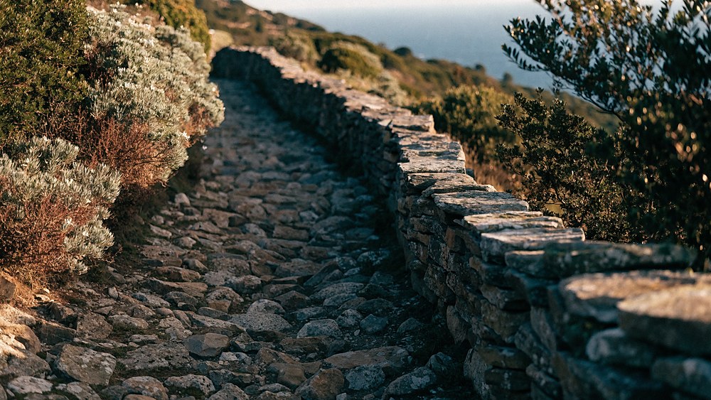
Trails and Paths on Elba Island — 314 km marked, from the sea to Monte Capanne
Over 314 km of routes in the National Park: from seaside strolls to the climb up Monte Capanne, all the way to the Grande Traversata Elbana.
300+
km of marked trails
1019 m
Monte Capanne, highest peak
GTE
Grande Traversata Elbana
CAI
white-red waymarking
Trekking and mountain biking
A paradise of trails
Elba Island is a true paradise for trekking and mountain biking, boasting a network of 314 km of trails and 60 km of dirt roads, far exceeding its 220 km of paved roads. With about 50% of its territory within the Tuscan Archipelago National Park, Elba offers trails for everyone: from technical paths for experts to easy walks for families. Climb the Monte Capanne, bike through the forests, or stroll along the coast. Every path provides stunning views, making the journey as rewarding as the destination. With an average of 1.4 km of trails per km², Elba is a must-visit destination for nature and outdoor sports enthusiasts.
Elba Island in numbers
01Area of Elba Island 224 km²
02Trails 314 km
03Dirt roads 60 km
04Paved roads 220 km
05Average trails per km² 1.4 km
06Average paved roads per km² 0.9 km
The trail network
A network to walk
Elba Island offers one of the richest trail networks in the Mediterranean. The Tuscan Archipelago National Park is crossed by over 300 km of marked trails for every level: from family strolls along the coast to demanding climbs up Monte Capanne (1019 m), the highest peak of the island and the whole archipelago.
The routes cross varied landscapes: fragrant Mediterranean scrub, vineyards and olive groves, chestnut woods on the slopes of Monte Capanne and stretches of rocky coast overlooking the Tyrrhenian Sea. Most main trails are marked with the white-red waymarking of the CAI (Italian Alpine Club).
Good to know: in autumn Elba hosts walking events and guided hikes with local nature guides. For longer or higher routes, good fitness and, ideally, a guide are recommended.
Easy difficulty
Routes for families and beginners
Ideal for families, untrained walkers or to enjoy nature without effort. Limited elevation gain, clear waymarking, short times.
Easy
Capo d'Enfola loop
Portoferraio · North coast
~4 kmlength~1h30duration~150 melevation
A scenic loop around the Capo d'Enfola promontory, the isthmus between two bays, with the former tuna fishery and wide sea views. Short climb, suitable for everyone.
Easy
Medici Forts and seafront
Portoferraio · Old town
~3 kmlength~1hduration~50 melevation
An easy walk through central Portoferraio between Forte Falcone, Forte Stella and the harbour, with views over the bay. Lovely at sunset too.
Easy
Among the Capoliveri vineyards
Capoliveri · Hills
~5 kmlength~2hduration~180 melevation
A hillside walk among the Capoliveri vineyards (Aleatico area), with views over the Stella and Lacona gulfs. In September it coincides with the grape harvest.
Medium difficulty
Routes for fit hikers
Require good fitness and hiking shoes. Medium elevation gain, partly technical terrain, 2-4 hours. Great panoramic rewards.
Medium
Volterraio Fortress
Rio · Medieval fortress
~7 kmlength~3hduration~350 melevation
Climb to the Volterraio Fortress (about 394 m), Elba's oldest fortification, of Pisan origin. Spectacular views over the gulf of Portoferraio and the archipelago islands.
Medium
Sanctuary of Madonna del Monte
Marciana · North slope
~5 kmlength~2h30duration~300 melevation
An old paved mule track from Marciana to the sanctuary set in the woods, linked to Napoleon's stay in 1814. A quiet atmosphere and views over the north-west coast.
Medium
Monte Perone and Le Calanche
Marciana / San Piero · Granite
~6 kmlength~3hduration~300 melevation
A route among the striking granite formations of Le Calanche, near Monte Perone, with wide views over the southern side of the island.
Hard difficulty
Peaks and routes for experts
For trained hikers. Significant elevation gain, rocky sections, several hours or several days. Proper gear and an early summer start.
Expert
Climb to Monte Capanne
Marciana · Summit 1019 m
~8 kmlength~4-5hduration~650 melevation
Elba's most iconic ascent: from Marciana to the highest peak of the Tuscan Archipelago, with granite-rock sections and a 360° view over Corsica, Capraia, Pianosa and Monte Argentario. Alternatively you can go up by the cable car from Marciana.
GTE
Grande Traversata Elbana (GTE)
From Cavo to Pomonte / Patresi
47-55 kmlengthmulti-dayduration4stages
The ridge route crossing the island from east to west: from Cavo to Pomonte (about 47 km) or to Patresi (about 55 km), passing the Monte Capanne area. Grade E, walked over several days (4 recommended stages). Best period: mid-September to May.
Indicative data: lengths, elevation gains and times are estimates and may vary with the exact route and conditions. Always follow the white-red CAI waymarking and an up-to-date Park map.
Plan your trekking
When to go, season by season
The best times to walk on Elba are spring and autumn (roughly mid-September to May), when the climate is mild and the views are clear.
🌸
Spring
★★★★★
Best season
Mar–May: ideal temperatures (15–22°C), scrub in bloom, fresh trails and no crowds. The perfect time for all levels.
Ideal temperature
Mediterranean scrub in bloom
Quiet trails
☀️
Summer
★★★
Best in the morning
Jun–Aug: intense heat on exposed routes. Only at altitude (Monte Capanne) are conditions cooler. Best to set off by 7:00.
Long daylight hours
Intense heat at midday
Higher wildfire risk
🍂
Autumn
★★★★★
Best season
Sep–Nov: like spring but with golden colours. Grape harvest, mushrooms and chestnuts. Open trails and perfect temperatures for the GTE.
Autumn colours
Mushrooms and chestnuts
Mild temperatures
❄️
Winter
★★★★
For those seeking quiet
Dec–Feb: cool and often sunny conditions. The trails are deserted and the villages live their authentic life. Coastal routes always possible.
No crowds
Crystal-clear air
Short daylight hours
Before you set off
The essential gear
🥾
Hiking bootsWith Vibram soles and ankle support for medium-difficult routes. For easy ones, sports shoes with non-slip soles are enough.Required for medium+ routes
🧢
Hat and sunglassesElba's sun is intense even in spring and autumn. Wide-brimmed hat and UV sunglasses for all routes in summer.Always recommended
🧴
WaterAt least 1.5 l for short routes, 2.5 l for medium and long ones. Natural springs along the island's trails are rare.Required
🧰
First-aid kitPlasters, disinfectant, elastic bandage, painkiller. Essential on routes far from inhabited areas.Recommended for medium+
📱
Charged phoneSave the route map offline on apps like Komoot, AllTrails or Maps.me. Useful numbers: CAI Elba, 118, Coast Guard 1530.Always
🧥
Waterproof layerEven in summer, weather changes can catch you out at altitude. A light windproof jacket weighs little and saves the day.Recommended at altitude
Find your way
Trail map
To plan your routes use the official Park and CAI maps, with up-to-date tracks and waymarking.
Tip: get the Elba Island hiking map (on sale in local newsstands and bookshops) and download the GPS tracks before you go, especially for long routes.
Got questions?
FAQ about Elba's trails
How many km of trails are there on Elba?
Elba Island has over 300 km of marked trails in the Tuscan Archipelago National Park, with white-red CAI waymarking, suitable for every level.
What is the Grande Traversata Elbana (GTE)?
It is the ridge hiking route crossing the island from east to west: from Cavo to Pomonte (~47 km) or to Patresi (~55 km), grade E. It is walked over several days (4 recommended stages), best from mid-September to May.
How do you climb Monte Capanne?
On foot from Marciana (about 4-5 hours round trip, with rocky sections) or by the cable car that departs from Marciana. The summit (1019 m) offers a 360° view over Corsica, Capraia, Pianosa and the Argentario.
What is the best time for trekking?
Spring and autumn (roughly mid-September to May): mild climate and clear views. In summer walk only in the early morning because of the heat.
Do I need a guide?
For easy, well-marked routes it isn't necessary. For the GTE, Monte Capanne or group outings, a local environmental hiking guide is recommended.
We use technical cookies to make the portal work. Only if you accept do we also use statistics cookies (Google Analytics), marketing cookies (Meta Pixel) and external content, such as YouTube videos and the ferry booking form. If you close this with the X, only technical cookies stay active. You can change your mind at any time from "Cookie Preferences" at the bottom of every page. Read the cookie policy.
Cookie Preferences
Choose which cookies to allow. Technical cookies are needed for the site to work and cannot be switched off. Your choice lasts 6 months and you can change it at any time. Details in the cookie policy.
Technical
Always active
They make the portal work: they remember your language during the visit and the choice you make here. Favourites you save stay in your browser only.
Provided by ElbaMyLove.
Statistics
They tell us how many people visit the pages and where they come from, so we know what to improve. We only see aggregate data.
Google Analytics 4 (Google Ireland Ltd).
Marketing
They measure the results of our Facebook and Instagram campaigns and may be used to show you ElbaMyLove ads on those networks.
Meta Pixel (Meta Platforms Ireland Ltd).
External content
They load YouTube videos in listings and news, and the ferry booking form. These services use their own cookies, including for profiling.


 Italiano
 English
 Deutsch
 Français