

 Italiano
 English
 Deutsch
 Français

Maps and Guides
of Elba Island — trails with GPX tracks, beaches and towns
Maps to consult and download to find your way around the island: the trail network, beaches by municipality, roads and connections.
Explore the island at a glance
Toggle layers from the panel on the left. Search by name of beach, attraction or town. Click each marker for details and links to the relevant pages.
Detailed maps and guides
Find detailed maps and guides of Elba Island to explore every corner with ease. This section includes hiking trail maps, beaches and coves, panoramic spots, villages and tourist attractions.
Perfect for independent travelers and those who enjoy organizing their own outdoor activities, beach days or cultural visits. Maps are available online or for offline use.
Plan your Elba adventure with accurate and updated maps designed to help you move freely and confidently.
Hiking and MTB trails
The entire island trail network drawn on the map, filterable by difficulty (tourist/hiking/expert), duration, elevation gain, side and type (loop/linear). Download GPX tracks and view the elevation profile of each route.
Printable PDF maps
Thematic ready-to-print maps to take on holiday. Useful in areas without mobile coverage. Road, CAI trails, MTB, mini-maps of historic centres, Napoleonic itinerary, mines, Elba DOC wineries, "Elba in 3 days" and "Elba in 7 days".
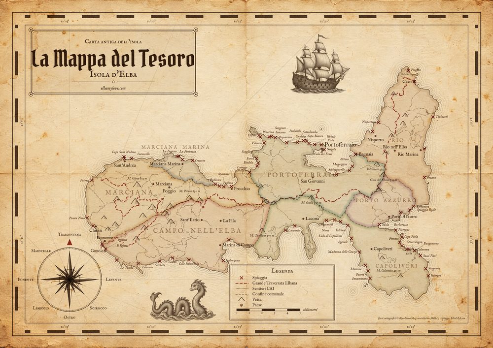
The Treasure Map
Our map of Elba Island in vintage cartography style: parchment, seven towns, marked trails, beaches with the X, wind compass. Open and print in A3 landscape PDF or keep it digital for your holiday.
Download the mapRoad map
The island roads, the 7 municipalities and all distances between towns. Ready to print.
Coming soonFull CAI trail map
Every marked CAI trail with its number on a single page. For serious hikers planning ahead.
Coming soonMTB map
Mountain bike routes with elevation profiles, climbs and difficulty levels.
Coming soonBeaches by wind
Which beach for which wind: libeccio → Cavo, grecale → Cala Cottoncello. A lifesaver in August.
Coming soonNapoleon's map
Villa dei Mulini, San Martino, imperial residences and the places of the ten months of exile.
Coming soonMines map
The mining sites of Rio, Capoliveri and Calamita: red earth, magnetite and over 2500 years of history.
Coming soonElba DOC wineries
The wineries of the Elba DOC consortium with a recommended tasting itinerary between Aleatico and Ansonica.
Coming soonElba in 3 days
Pre-made itinerary for a short stay: what to see, when, routes and top beaches.
Coming soonElba in 7 days
A whole week to discover the island from north to south: villages, trails, beaches and quiet moments.
Coming soonHistoric centres of the 7 towns
Mini-maps of the historic centres for your stroll: alleys, churches, squares and viewpoints.
Coming soonHow to use Elba maps
Practical articles: reading CAI trail signs, trail colour codes, the 10 panoramic views of the island, code of conduct in the National Park, recommended offline navigation apps (Wikiloc, Komoot, Maps.me, AllTrails), historical Elba cartography.